
As with many other sports, orienteering has many different disciplines (variations). These variations mean that as many different people as possible are able to take part in some form of orienteering. If you find that you do not like traditional foot orienteering, then you may find that you enjoy an alternative discipline much more. Here is some information about orienteering disciplines that you can try in and around the UK.
Traditional Orienteering
Foot orienteering is normally done a rural setting on open access land, in a forest or on a private estate where participants are not constrained by public Rights of Way. Participants are given a special map of the area where the course is. This map is more detailed than a standard Ordinance Survey map and includes a lot of symbols that cannot be found on normal maps. The maps shows the location on control points, but it does not show the best route between each control.
Some routes will have specific points that must be visited which are not considered as control points. These are normally crossing points or bridges which the participants must use for safety reasons. Although competitive orienteerers will run or jog their way around the course as solo participants, many people do walk these courses because they enjoy the hunt rather than the race. In order to run or jog across difficult terrain, such as uneven forest floors, participants need good core strength, agility and endurance.
Cycle Orienteering
Cycle orienteering is normally done on a mountain bike. Participants ride between controls rather than running. Mountain bikes are recommended for participants because they are better for covering a mixture of different terrains.
Most cycle orienteering courses are much longer than traditional foot courses. Cycle orienteering for adults is divided into two main categories: Mountain Bike Orienteering Score (MBO Score) and Multi-Terrain Bike Orienteering (MTBO).
In MBO Score, riders use an OS map marked with controls. Each control is given a points value and participants must try to visit as many of them as possible in the allotted time. There is no set order to the course, so participants must decide on the best way to score points in the given time. The best MBO Score riders are those who are good at planning their strategy. MTBO uses orienteering style maps, rather than OS maps. It usually takes place in forests where there are plenty of tracks and trails for participants to choose from. In MTBO, riders must go around the course in a particular sequence.
Ski Orienteering
Ski orienteering is a winter sports version which is primarily practiced in Northern European countries and North America. Detailed orienteering maps show gradient of the trails, distances and quality of the ground. Participants must navigate the course on skis, and they therefore need to be physically fit and able to ski cross-country. Distances range from sprint distances through to long distance courses.
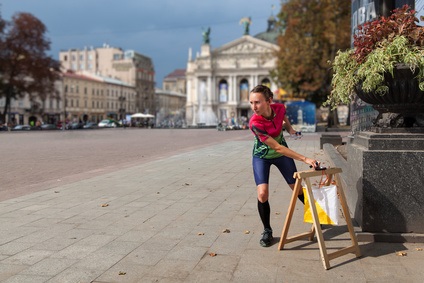
Urban Orienteering
Urban orienteering is orienteering around a city, town or other built up environment. The types of challenge which are faced by urban orienteering participants are very different from those that are faced by orienteering participants in the open countryside. Urban orienteering participants have to be aware of very different hazards, such as moving vehicles and pedestrians.
Night Orienteering
Night orienteering is done once darkness falls. Participants are expected to navigate the course in low light conditions. Participants can use a torch to help them to get around the course, although this will only provide them with a limited amount of light. Most participants choose to use a head worn torch as this enables them to have their hands free as they are moving around the course. Limited visibility means that participants are normally unable to see distant landmarks, and they therefore have to be very aware of their immediate surroundings.
Trail-O
Trail-O (also known as precision orienteering) is a form of orienteering that relies on precision, rather than speed. It normally takes place entirely on trails, so that the sport can be more accessible to people with physical disabilities. Courses contain a higher number of “control” markers than a standard orienteering course; however many of these markers are decoys. Participants are forced to choose the right control at each point, based on the map and control description information that they have available to them. Points are awarded for selecting the correct control.
Depending on the type of trail-o course that is being run, participants may be given a negative score if they choose the wrong one. Final rankings are given based on points scored, rather than time taken to cover the course. This means that making the right choices about each control is essential. Trail-O is perfect for people who prefer the map reading aspect of orienteering to the speed aspect.